|
|---|
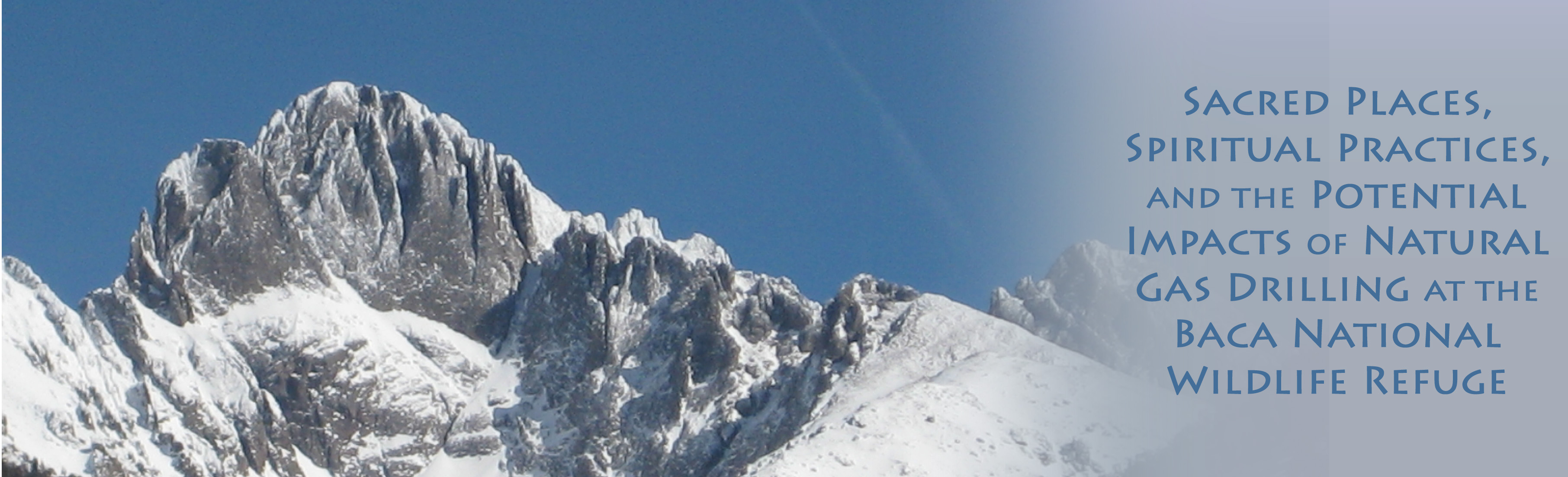
| Voices | Topics | Info |
|---|
This draft Environmental Assessment (1/18/08 – USFWS) does not meet the definition of “Environmental Assessment” as defined by NEPA. This failure to meet the definition stands on its own merits for an EIS due to the following:
From para 1.0 of the EA, “Purpose and Need”: “. . . . The purpose. . .is to ensure that initial exploration of the mineral estate under the Baca National Wildlife Refuge by Lexam. . . .is conducted in a reasonable manner…”
From para. 1.3 of the EA, “Purpose and Need for the Proposed Action”: “. . . . The purpose. . .is to ensure that initial exploration of the mineral estate. . .is conducted in a reasonable manner…”
From title: “Draft Environmental Assessment of Planned Gas Oil Exploration, Baca National Wildlife Refuge, Saguache County, Colorado”
These descriptions/titles do not fulfill the purpose of an EA as defined by NEPA, per Section 1508.9 and Council on Environmental Quality’s Handbook, as referenced above. It is also clear from the NEPA definitions that the intent is to determine the significance of a federal activity, thereby determining whether an EIS is the appropriate step. This draft EA has not met these requirements and has neither fully nor thoroughly examined the issues and potential impacts in determining the full “significance” of most of the issues shown in the following bullets.
1. One example of oversight of “significance” is referring to “temporary” as though “temporary” alleviates significant impact. Point #7 Section 1508.27 NEPA states:
“Significance cannot be avoided by terming an action temporary or by breaking it down into small component parts. . .”
The following are examples in the EA in which the issue or impact discussed is dismissed as “ not significant” because of its temporary nature:
It is evident more assessment and research is required to determine the full impact in these areas. Being “temporary” does not exclude Lexam’s oil and gas exploration from resulting in a potentially significant impact.
2. The National Environmental Policy Act and the CEQ regulations are concerned primarily with those “major federal actions significantly affecting the quality of the human environment” (42 U.S.C. 4332):
“Accordingly, agency procedures, resources, and efforts should focus on determining whether the proposed federal action is a major federal action significantly affecting the quality of the human environment”.
Many issues, proposed actions, and cumulative impacts discussed in the draft EA do not fulfill the NEPA requirements in determining significance of the action.
3. From item #4, Section 1508.27:
“The degree to which the effects on the quality of the human environment are likely to be highly controversial”.
The current plan to drill in the Baca Wildlife Refuge is highly controversial, as illustrated by the following:
a. The lawsuit by the Ecosystem Council resulting in the aforementioned EA and a federal court ruling against the USFWS.
b. The intense involvement of the community with COGCC meetings, both in Denver and local regions
c. The formulation of new groups, such as the San Luis Valley Citizens Alliance who oppose the drilling in the refuge
d The regular meetings of the various citizen action groups, including the San Luis Valley Citizen’s Alliance, the Ecosystem Council, the Water Watch Alliance, and the San Luis Valley Water Protection Coalition, who oppose this drilling
e. The fact that during the public scoping process, over 48,000 comments were received by the USFWS, the vast majority of which opposed the drilling. Since the draft EA states that less than 100 people reside in Crestone and less than 1000 live in the Baca, clearly visitors, tourists, associates, family members, and people across the nation are also extremely concerned about the negative impacts of the drilling.
f. Representative John Salazar has written the USFWS in Washington sharing his “grave” concern about protecting the Wildlife Refuge during the drilling process.
g. The Denver Post article, “Baca Refuge open for drilling?” dated 12/19/08 and included in Appendix A, expresses a clear controversy, with statewide coverage, of the proposed drilling. (See also Bullet II below for quotes.)
h. The community members, all decidedly outspoken at the public forum held by the USFWS on 2/12/08, emphatically requested an Environmental Impact Statement. There were approximately 100 in attendance. Speakers voiced serious concerns about the drilling process and asked why an EIS was not to be performed. During a four-hour meeting that was finally called to an end by the facilitator, who was a representative of the USFWS, the USFWS was advised that the community as a whole did not believe that the draft EA met the definition of what an Environmental Assessment was per NEPA. Of all the community members who spoke, none were in favor of drilling and approximately 80% demanded a full EIS be performed. Others demanded that there be no drilling.
Evidence of controversy extends to the local newspaper, “The Crestone Eagle”. For example, in the February edition alone, there are eight articles on the Lexam drilling issue, including the front page article, “Draft EA Released on Wildlife Refuge Drilling”. The eight articles do not include editorials or classified. Potential impacts to the Crestone area are difficult to find in the EA.
This section of NEPA (1508.27 #4) has been overlooked and/or avoided in this draft EA.
Due to the controversial nature of the proposed oil and gas exploration and its potential impacts on the human environment, we demand the USFWS commence with a full EIS to determine the full significance of the impacts as a result of the exploratory drilling in the Baca National Wildlife Refuge.
Refer to para 4.7 Cultural Resources in total of the draft Environmental Assessment (1/18/08 – USFWS).
The area immediately surrounding the Baca National Wildlife Refuge, especially to the east, possesses unique cultural characteristics that are very well documented. (See Appendix A.) The draft Environmental Assessment mentions “over a dozen spiritual centers,” when, in fact, there are over 20 spiritual retreats/centers (some sources state over 24), not to mention a multitude of individuals and families who are located in this area for the vistas and quiet that augment and support a spiritual environment. Nearly all citizens who relocate to this area do so for these aesthetic reasons. The values they bring with them combine with the spiritual centers to formulate a unique environment. This cultural “uniqueness” with its spiritual heritage has not been addressed in the draft EA. The potential significant impact to this cultural resource is great and must be fully assessed. This discussion (“cultural uniqueness”) may very well apply to the draft EA’s section on “Socio-economic impact” as well.
Please review the following quotes with references to support the cultural uniqueness of the Crestone/Baca area. The full articles are included in Appendix A.
From U.S. News & World Report, dated 11/16/07, “A Spiritual Community Takes Root, Crestone, Colorado”, by Jeffrey Paine
From New York Times, dated 1/11/08, “For Many a Follower, Sacred Ground in Colorado”, by Finn-Olaf Jones.
These quotes make it abundantly clear that the area surrounding the Baca Natural Wildlife Refuge is unique and possesses international acclaim, especially with its diverse spiritual centers.
Social engineering, which is a viable NEPA consideration when performing an Environmental Assessment, includes not only historical and archeological factors, but also the economics and factors such as aesthetics, lifestyles, type of community, politics of the community, and religions/spirituality of the community. Nowhere in this draft EA is mention of worldwide attraction to this culturally and spiritually appealing area. Nowhere is mention of the uniqueness of this area due to the aesthetics and the wide variety of coexisting spiritual and religious groups. Nowhere in the EA is an assessment of the impacts of drilling to such a community. An assessment of such a community and geographical location would be required by a number of points in Section 1508.27.
Furthermore, the cultural and aesthetic impacts are delicately interrelated. Impacts to the environment and to humans (not to mention the habitat) such as noise, night lights from the rig, visual impacts to the vistas will definitely affect the community and the uniqueness of the culture. Significant impacts will potentially drive people from the area, reducing property values, and more importantly will deprive many people of the solitude of nature and the pristine vistas—the very reason most live in the area to begin with. Overlooked is the critical commodity of the Crestone area; i.e., pristine views, quiet, spiritual retreats, and etc.
The only ingress and egress route to this cultural center is CR-T. This road passes within a mile or two of the proposed drilling operation. Every single person, including all tourists visiting this unique spiritual center and community, will see and hear the proposed drilling rig(s). (For more on the visual impacts and noise pollution see bullets IV and V below.) As for the visual impact, views from CR-T were not considered in any depth whatsoever.
The cultural impacts must be assessed more thoroughly because of these documented factors. The area adjacent to the proposed drill sites are unique for the mentioned reasons. However, no assessment of these cultural factors was made in the draft Environmental Assessment.
From NEPA Section 1508.27, “Significantly,” as used in NEPA requires considerations of both context and intensity: (a) Context. This means that the significance of an action must be analyzed in several contexts such as society as a whole (human, national), the affected region, the affected interests, and the locality.
This draft EA does not evaluate the full effects on the culture of the affected region (Crestone, Baca, and the retreat areas) as defined by NEPA.
Also, in the same section;
(b) Intensity. . . .
3 . Unique characteristics of the geographic area such as proximity to historic or cultural resources, park lands, prime farmlands, wetlands, wild and scenic rivers, or ecologically critical areas.
4. The degree to which the effects on the quality of the human environment are likely to be highly controversial.
5. The degree to which the possible effects on the human environment are highly uncertain or involve unique or unknown risks.
7. Whether the action is related to other actions with individually insignificant but cumulatively significant impacts. . . . Significance cannot be avoided by terming an action temporary or by breaking it down into small component parts.
Again, this draft EA does not evaluate the full cultural effects, uniqueness, the human environment, proximity to cultural resources, controversial effects, highly uncertain or unique risks, cumulative impacts, and etc. as defined by these NEPA requirements as being potentially significant. Additionally, many unknown risks, such as the effects on the culture of the region, were not addressed.
Refer to paragraph 4.7.5.2 Proposed Action of the draft EA:
“The cumulative impact study area for cultural resources encompasses the Refuge”.
The potential impacts of drilling extend far beyond the Refuge into the areas discussed above, and need to be considered as required by Section 1508 of NEPA, but the cultural heritage, world-wide acclaim and attractiveness, etc., in the adjacent lands was not even mentioned, much less assessed.
Further Discussion on the Uniqueness.
Impacts on cultural resources, such activities as oil and gas exploration, are important to the people of Crestone, yet many of the reasons are somewhat difficult to objectify. Cultural resources in our unique environment include spiritual dynamics.
Spiritual dynamics describe a state of being with related qualities of consciousness and energy systems that are not commonly understood and rarely addressed by other communities. These dynamics require peace and quiet in order to exist.
“Cultural resources” in this community are not by any means limited to graves and historical artifacts. Our unique resources are the many spiritually based groups and individual representatives of outside organizations as well as individuals privately observing and experiencing their own spiritual existence. These are not only resources to the local people but are also constantly used by people from around the world, as referenced in the quotes. Pilgrims and dedicated visitors utilize our lands and area daily in research, teaching, and application of spiritual dynamics.
The draft EA completely ignores this most significant area of cultural resources, not considering the essence of the community nor the most sacred and valued requirements of the community. Spiritual activity, as outlined in the referenced quotations, is extremely sensitive to disruptions (such as a gas or oil exploration process) to individual peace, meditation, and prayer. These disruptions, in all of the various manifestations, were not considered in any measure.
This must be approached as “religious practices as an integral part of the culture, tradition and heritage forming the basis of community identity and value systems.” (Context from the American Indian Religious Freedom Act of 1978.)
Before a usable evaluation can be produced it is necessary for the involved governmental and contract agencies to have an exhaustive briefing on the cultural frames of reference in this area of spirituality, religious practice, and cultural uniqueness.
Because the draft EA fails to take into account the cultural uniqueness and true interest in spirituality in the affected area, we demand the USFWS commence with a full EIS to determine the significance and cumulative effects, as defined by NEPA of the impacts to the cultural resources as a result of the exploratory drilling in the Baca National Wildlife Refuge.
Refer to para. 4.1 Introduction (from Environmental Consequences 4.0) and para. 1.4 Conformance with USFWS Management Plans of the draft Environmental Assessment.
Paragraph 4.1: “Since the USFWS has not developed specific management plans . . . .”
Paragraph 1.4: “The Refuge conceptual management plan (2005) provides a broad overview of the USFWS’s proposed management approach to wildlife and their relative habitats, public uses,. . . . .until such time that a full comprehensive conservation plan can be created. The comprehensive conservation plan (CCP) planning process for the refuge is scheduled to start with baseline data collection in 2008, but development of the CCP will take several years.”
Paragraph 1.4: “Given the limited scope of Lexam’s current proposal, the USFWS has determined that it can commence prior to preparation of the CCP . . . .”
We are extremely concerned that the USFWS does not have a specific management plan in place at this time, nor will have one in place during the gas exploration period. We have outlined three serious concerns:
Paragraph 2.2: Lack of Funding and Personnel (CMP 2005 USFWS): “With the addition of the Baca National Wildlife Refuge to the Refuge Complex, Congress significantly expanded the Services’ acquisition authority and subsequent management responsibilities in the San Luis Valley, without expanding its operation budget and personnel base. No additional funding or personnel are dedicated to the . . . .operation of the refuge. . .”
“Personnel required to effectively administer operations and management at the refuge include a refuge manager, biologist, administrative assistant, two maintenance workers, a full-time law enforcement officer, . . . Without sufficient personnel and funding, most if not all of the goals and action items described in this CMP will be difficult, if not impossible, to attain.”
If the goals and actions of this conceptual management plan cannot be met without the introduction of an added drilling process on the Refuge, how can the Refuge be managed adequately with the addition of a drilling process on the Refuge? There are many mitigations and directives for the drilling company to follow. Who will enforce these directives? Who will ensure that safety requirements, environmental risks, and the bullets outlined in the draft EA for Lexam to follow are enforced?
Paragraph 5.1: Ecological and Biological Resources (CMP 2005 USFWS). “The refuge occurs in a unique and complex hydrological and geomorphological setting. For example, five significant drainages spill off the adjacent Sangre de Cristo Range and disappear into the ground on the refuge, feeding both the shallow, unconfined and underlying, confined aquifers. This, along with wind and other natural forces, supports one of the most unique systems in North America, the Great Sand Dunes.. . .The complexity, uniqueness, and value of these new refuge lands demand that refuge managers begin to better understand the geomorphological setting, as well as other important abiotic characteristics such as soils, in order to effectively manage the unique habitats found on the refuge. Complicating effective management and monitoring of this system is the reality of a relatively small refuge staff with very limited resources.”
“Refuge staff have identified geomorphology, hydrology and other abiotic factors influencing habitat as the most critical research and monitoring needs. Monitoring fish and wildlife, albeit critical to the success of refuge management, will be secondary until a better understanding of the physical setting those animals depend upon is obtained.. . . .it is clear that the specific research and monitoring studies must be designed to provide information to assist refuge managers in making well-informed on-the-ground decisions.”
“The biological significance and condition of the resources is not fully understood at this time due to limited access and lack of widespread biological inventories. However, given what is known from the inventories conducted by the CNHP within the Closed Basin region, the refuge clearly represents a vital component in a large complex of relatively unaltered and intact lands with high biological diversity and ecological richness.”
Paragraph 5.3: Hydrological Resources (CMP 2005 USFWS):“. . . .In most areas, the unconfined aquifer ranges to a depth of about 100 feet. Where the unconfined aquifer comes to the surface, natural seeps, wet meadows and interdunal wetlands typically result. Below the unconfined aquifer are a number of clay-based layers that serve to separate, although not disconnect entirely, the unconfined aquifer from the deeper layers of sands and gravels containing water in the confined aquifer. . . . In areas where water from the deep aquifer can access the surface through either fractures in the clay layers or wells, artesian water pressure is common.’
“From a water resources standpoint, one of the first priorities will be to assemble all available hydrological information and data.. . . which if obtained, could significantly improve our understanding of the critical hydrological processes. . . .The hydrology of this region is the glue that holds the Great Sand dunes ecosystem together and the refuge will play a major role in maintaining and protecting the stability of this resource and the wildlife resources it supports.”
These statements made by the USFWS from the Conceptual Management Plan (2005) point to the serious need for a baseline inventory in the Refuge. It calls not only for a habitat inventory, but also for a better understanding of the hydrological setting, topography, and overall system to assess the real risks of the drilling operation. Fracturing the clay layers could have a significant potential to release water pressure, thereby mixing the various aquifers that feed the Great Sand Dunes. The real risk is that the drilling process could pollute not only the immediate area of the refuge, but introduce toxins into the aquifers that merge with the larger area, eventually feeding south to the Rio Grande River and other states. Additionally, the statement by the USFWS, “The hydrology of this region is the glue that holds the Great Sand dunes ecosystem together”, would appear to mandate a thorough evaluation and baseline studies to this area prior to any drilling. Toxins and pollutants entering the aquifer at any depth could have serious consequences to the Great Sand Dunes National Park, not to mention the refuge and areas the aquifers feed to the south of the refuge. The draft Environmental Assessment does not take these factors into consideration.
Because the USFWS CMP stresses its lack of funds and resources to properly manage and oversee the Refuge, and because the USFWS states that the hydrology of the Refuge is the glue that holds the Great Sand Dunes ecosystem together, we demand the USFWS commence with a full EIS to determine the significance of the impacts on the habitat and the aquifers as a result of the exploratory drilling in the Baca National Wildlife Refuge. An EIS would also consider the cumulative affect to these areas/regions should the aquifers become polluted.
Refer to para 4.11 Aesthetics (in total) of the draft Environmental Assessment (1/18/08 – USFWS).
We are concerned there is no paragraph titled: Cumulative Impacts, as all other sections incorporate such a title with applicable summary statements.
This section of the draft EA is weak and limited to the study of views from the Dunes and from Highway 17. These are not the areas of prime concern to local residents. The draft EA does not discuss the views from communities of Crestone and the Baca, including the treasured spiritual retreats mentioned in Bullet II above. An assessment of the visual impacts to our community, which abuts the Refuge, was not performed.
Appendix B (attached) provides an example a sample environmental assessment of visual impacts. The example is that of the Vietnam Veteran’s Memorial Visitor Center in Washington D.C. Also in Appendix B is an example of an Environmental Impact Statement, “Draft EIS for Cherry Point Cogeneration Project”, which should be accomplished as well in the case of Lexam drilling in the Baca Refuge. In the referenced EA and EIS, much time was taken to assess the actual visual impacts from all directions and from all roads. They took the time to collect data, including traffic levels, tourist traffic, day and nighttime lighting, and etc. We understand that these two examples are studies of much different activities, but the issue is to make the full assessment as dictated by NEPA. A full and comprehensive visual assessment was performed under EIS 36 and the essential process of EIS 36 can be referenced in Appendix B as well.
In the Baca, with the drilling taking place only a few miles away, a visual assessment must be taken from the populated areas— from the East— and from the primary traveled roads in the community, not simply Highway 17, which is not the road used in everyday travel within our community.
For an example, refer to Figure A below. This is a picture taken in the center of the Baca populated area looking west from one of the stupas. This view looks directly into the Baca Wildlife Refuge. If drilling were to occur, the rig(s) would be visible. Appendix B contains more pictures taken from near the Baca Refuge looking east and south. In all pictures, the addition of a drilling rig(s) would destroy the pristine view from the residential areas and the spiritual retreat centers, with the possible cumulative effects of residents moving out. To say that the rig(s) are temporary does not satisfy the NEPA definition per Section 1508.27, bullet #7.

Figure A: View Looking West from Baca Retreat/Residential Area to Drill in the Baca Refuge.
Figure B, below is another picture taken from a residential road looking into the Baca Refuge as well. It is taken from Chalet I, a residential area.

Figure B: Looking West from the Baca residential area into the Baca Wildlife Refuge.

Figure C: Looking East. The Refuge is just behind the farm.
A typical visual impact study for public safety radio towers (by state or federal agencies) incorporates the following as a minimum to determine the impact:
In other state and federal activities, such as United States Coast Guard public safety radio towers, extensive assessments are performed to evaluate more adequately such structures’ imposition to the surrounding area. Great consideration is given to the visual impacts of these structures on the local community.
A full EIS would sufficiently address these issues.The visual effects to such a community are most likely significant under Section 1508, points #3, #4, #5, and #7 of NEPAand would necessitate an EIS. However, the current draft EA does not address the visual impacts of concern in any measure, so a determination about their impacts cannot be made without an EIS. We are deeply concerned that the visual impacts to the nearby community and residences were not performed.
Also of concern to us are the inadequate points made in paragraph 4.11.1.1 of the EA. The following are itemized quotes from this paragraph, with our rebuttal/comment included:
1. “The drill rig, facility lighting, roads, and drill pads, which may be visible by viewers at a distance of 2.0 miles or greater. . . .”
Inconclusive: The human eye can see a 135-foot structure far beyond 2.0 miles, especially when the backdrop is 100% natural setting. This is analogous to a 6-foot man stating that he may be taller than 3 feet. From the Baca area looking west on a clear day, the opposite side of the valley 60 miles away (the San Juan Mountains) is visible, the Great Sand Dune National Park is visible from approximately 10 miles away, and more importantly the Baca Wildlife Refuge is distinctly visible. Again refer to Figure A from the Baca as an example.
2. (In reference to night lights) “although shielded lighting could potentially reduce the nighttime glare, even the most rigorously mitigated light plan would not eliminate nighttime glare from a facility that must comply with OSHA’s lighting requirements.”
Incomplete assessment: By saying “could”, there’s no mention of a mitigation plan. OSHA’s requirements would be specific to the drill site, more specifically to the equipment itself. The EA does not provide a mitigation plan to reduce the nighttime glare.
Mitigation Plan: One possible mitigation is building a structure of fine mesh around the rig, encompassing all four sides with a solid top that would allow ventilation but diminish the negative impact of the lights at night. The draft EA admits the impact to the night sky but does not show any pictures or discuss the significance of the impact. No mitigation plan was considered by the draft EA, but would be encouraged during the EIS phase to 1) reduce nighttime glare for sky watchers as well as various astronomy classes offered by the Colorado College 2) reduce effects to the wildlife.
Snow Cover: There was no consideration for the glare and bright reflection at night due to snow cover. In 2007-2008, snow has remained on the ground since December 100% of the time. The nighttime glare of the bright lights could eliminate the night sky views entirely in the region around the drill site. No mitigation was placed on this glare.
3. “Diminishment of the viewshed is a concern with regard to visitors to the Great Sand Dunes National Park located adjacent to the Refuge. The closest proposed location. . . ., but is about 18 miles northwest of the park visitor center. The vast majority of visitors to the park will be at the visitor center and immediate environs….the elevation of the dunes. . . preclude viewing from the visitor center”.
Misleading: The allusion to the Great Sand Dunes is applicable for the National Park, but not at all for the Crestone/Baca residential area. Many residents live less than 5 miles from the Refuge. To say that the majority of park visitors are at the visitor center is an assumption and is irrelevant to our community.
Inadequate/Incomplete: This assessment does not take into account the visual impacts to the Baca residential area or the greater Crestone area. It focuses on the Dunes National Park, misguiding the reader to perspectives from the Dunes without consideration for the nearby residential area. The entire discussion in 4.11.1.1 is inconclusive, inadequate, and somewhat misleading as far as a complete visual assessment is concerned.
4. “The impacts would be temporary in nature. Therefore, visual impacts would be less than significant”.
Violates NEPA: Per Section 1508.27, bullet #7, “significance cannot be avoided by terming an action temporary”.
Inconclusive: This discussion in the EA, para 4.11.1.1, is weak, inconclusive, inadequate and irrelevant to the Crestone and Baca Grande communities. For more realistic views and impacts please refer to Appendix B for pictures taken of the drill area from scenic overlooks, or from near the Wildlife Refuge to scenic vistas in which the drill rig would protrude near the middle. Also included in the appendix is a photo simulation of a drill rig in front of the Dunes National Park. This photo “sim” was done by Lexam Explorations and placed on their publicly accessible website. Compare this picture with the discussion in paragraph 4.11.1.1 of the draft EA. There is an obvious disparity between the two.
Although, there is mention of the effects of the nighttime lights on the habitat, the impact was not assessed in any detail. There needs to be a baseline study done of the habitat in the Refuge to determine the migration patterns, feeding habits, and the exact species present in the drilling area. A discussion of nocturnal animals and the effects on their patterns would be needed.
Because the draft EA overlooks the possible visual impacts from the surrounding communities and dismisses their significance due to the fact that they are temporary in direct opposition to the NEPA definition of significance, we demand the USFWS to commence with a full EIS to determine the significance of the visual impacts as a result of the exploratory drilling in the Baca National Wildlife Refuge.
Refer to para. 3.11.2.1 Ambient Soundscape Setting of the draft Environmental Assessment.
“. . . .The planned project will occur in a rural agricultural area. . . .other noises associated with rural areas include vehicles, farm machinery, and semi-tractor trailers. . . . background noise levels in rural areas typically range between 35 and 45 dBA(Ldn)(USEPA 1974).”
We bring into question the reference to the Baca Refuge being a “rural agricultural area”. It is a nonresidential, non-farming, wildlife refuge. The actual ambient noise levels are not commensurate with the noise levels referenced in the draft EA. Though we do not challenge the reference to USEPA 1974 data stating background levels for rural areas are between 35 dBA and 45 dBA, we do refer you to EIS 36, which is promoted by the EPA, as being a model EIS for noise and visual impact studies and processes. EIS 36 baselines ambient noise levels for a rural area as 30 dBA, obviously below the 35dBA – 45dBA range referenced in the draft EA for rural areas.
However, we are not located in a rural area. Livestock, tractors, machinery, and so on are not prevalent on the refuge. Clearly the ambient noise levels are lower than the draft EA’s reference of 35 dBA – 45 dBA.
Real-time data, along with data commensurate with the Baca National Wildlife Refuge, is outlined and explained below and reflects ambient dBA levels far below 35 dBA. Averages below 30 dBA are the norm for such refuges and terrain.
Discussion on Sound
The following will assist in understanding the real impacts of increased sound levels due to drilling in a wildlife refuge.
The acoustic energy between 25dBA and 45dBA is an increase of 100 times and represents a six fold increase in subjective sound level. The increase of sound energy from 15dBA to 45dBA is 1000 times, and an increase in sound energy level from 15 dBAto 55dBA is 10,000. This increase of sound energy from 15dBA to 55dBA (the State of Colorado Statute 25-12-103) is a probable scenario based on the enclosed data from similar terrains and actual data taken at the Refuge border.
The draft EA is incorrect in addressing sound/noise with data that is obtained from nonequivalent sources. No sound measurements were performed in the location of the Baca NWR by the draft EA. Sections 3 of the draft EA is misleading, nonapplicable, and in many ways irrelevant to the potential noise impacts to the BNWR.
Animal studies have shown an avoidance of noise levels over 45dBA when they are free to choose locations. Bird songs and calls are masked by noise. The Mountain Plover vocalizations are masked by noise levels of 45dBA or higher. (See Appendix C for back-up data and source documentation.)
Prolonged exposure to noise negatively impacts human health, causing mental and body fatigue, insomnia, headaches, muscle aches, irritation, anxiety, depression, and raised blood pressure. (Proc Inter-Noise, 2005, 5, 2809-2812.) The cost of adaptation to noise by animals and humans is significant and not addressed by the draft EA.
Sound Basics:
The human ear responds to sound/noise in a nonlinear manner. The scientific measure of sound perception is the decibel (dB), which is logarithmic and represents the subjective response to sound energy level. The smallest difference in sound perceived by humans is 3dB and is a 2 times increase in sound energy. The ear is able to perceive the faintest of sounds (0dB) up to extremely high levels of sound energy (120 dB—the pain threshold) that is a trillion times the sound energy of 0dB. The ear accomplishes this by decreasing its sensitivity as sound becomes louder. A modified measuring curve, dBA, attenuates the high and low frequency response of the measuring instrument to approximate the response curve of the human ear.
Another measurement is the Ld/n, which refers to the daytime and nighttime levels and adds a 10db penalty for the greater impact of loud noise at night. This concept was important in helping to develop noise mitigating techniques for the Highway 36 Corridor EIS study in Northern Colorado.
These “sound basics” do not appear to be taken into consideration in the draft EA.
The BNWR is a wildlife preserve adjoining a retirement and spiritual retreat community. The ecosystem of the wildlife refuge approximates that of the Hovenweep National Monument located 20 miles west of Cortez, Colorado, in which scientific studies of sound have been performed. This data reflects ambient noise levels far below 45 dBA, and in some winters averages below 18.2 dBA.
In addition, similar ecosystems studied in the Grand Canyon shows natural ambient sound levels in the range of 5dBA to 45dBA with a median of 16.7dBA and mean of 19.6dBA. (Ambrose, S., USFWS retired, 2005 NPS Report #GRCA05-02).
In the Hovenweep National Monument, which has vegetation similar to that found in the Baca NWR, the range was 16.5dBA to 24.7dBA in summer and 15.6dBA to 18.2dBA in winter (Ambrose, S. unpublished data.). See Appendix C for the complete listing of dBA readings over time.
In these two examples with comparable habitat and vegetation we have:
(Both of these reports were made by Scott Ambrose, a retired USFWS employee.)
Vince Palermo, retired M.D. and Crestone resident, recorded the following ambient noise levels. The location was near, but not on, the BNWR with an Extech sound level meter.
Baseline Representation: Representative ambient sound energy levels adjacent to the Baca NWR are:
Reading |
Place |
Time |
Date |
26.5dBA |
Chalet I, 262 Moonlight Way, side deck |
4:05pm MST |
2/18/08 |
25.7dBA |
Spanish Creek Trail, in trees |
4:20pm |
2/18/08 |
25.6dBA |
Spanish Creek Trail, open area |
4:21pm |
2/18/08 |
25.2dBA |
Carmelite Monastery, near retreat hut |
5:05pm |
2/18/08 |
25.7dBA |
Carmelite Monastery, devotional path |
5:15pm |
2/18/08 |
26.5dBA |
N. Crestone Creek, campsite #11 |
3:15pm |
2/19/08 |
31.6dBA |
N. Crestone Creek, Trail 744, stream/40 ft, snow |
4:15pm |
2/19/08 |
26.2dBA |
N. Crestone Creek, stream/50 ft, snow |
4:45pm |
2/19/08 |
These readings reflect average ambient dBA levels near 26 dBA, well below the draft EA’s baseline of 35 dBA – 45 dBA. It is probable that baseline data taken from the drill site will reflect ambient levels even lower than this due to the inability to access the interior of the refuge. An EIS is necessary to baseline the levels on the refuge, and more importantly to assess the increase from the baseline to the allowable of 55 dBA. It is possible, as outlined above, to have a sound energy level of increase of 10,000 from the ambient due to the drilling operation.
Furthermore, many birds use sound as a primary means of communication to seek mates, establish territories, and avoid predation. Some birds respond by upping the volume of their singing, which can have an energetic cost that may affect the robustness of the individual bird and its ability to reproduce and care for its offspring. The following is taken from Patricelli and Blickley study in 2006:
“A typical song volume is approx. 75dBA. In an environment where there is likely to be sounds which mask the bird vocalizations, life sustaining tasks like breeding, territorial disputes, and avoiding predation can be daunting. They had 3 sound sources, 2 drilling rigs and one production compressor. With one rig the masking at 512 meters was strong enough that the birds needed to be closer than 16 meters for vocalizing to be detected. The bird signal likely needs to be 16dBA to 18dBA above the interference noise in order to be detected and possibly 3dBA higher than that to be discriminating as to the information contained. Animals do have auditory adaptations but is difficult at this time to know the effectiveness in overcoming the masking impact. With some bird species there is an ability to increase the volume of vocalizations which has an energetic cost which may affect the health of the individual bird but there is a need for more study in this area and it appears that the MP is not a species which would be likely to use increased volume as method to overcome loud noises and the masking found within.”( See Appendix C for full article.)
This is another area where further research in noise assessment and effects on wildlife is needed.
From paragraph 4.11.2.1 of the draft EA: “ . . . noise levels would attenuate to 43.1 dBA, within the ambient noise range for the setting of the proposed project and well below the Colorado statutory maximum permissible noise level in a nighttime residential setting (50 dBA)”.
Again, this statement from the draft EA alludes to the refuge as being residential. To use “residential” as a baseline or as a maximum misses the real assessment of the BNWR. The BNWR is not a residential area.
Refer to para. 3.11.2.1 Ambient Soundscape Setting of the draft Environmental Assessment:
“A NPS noise study conducted at the then Great Sand Dunes National Monument during July 1993 and October of 1994 found ambient noise levels averaged less than 45 dBA for 99 percent of the study. . . .”
Concerns and Questions from this statement:
1. Why were the ambient levels taken from the Dunes National Park, a location further from the drilling than many local residents?
2. In what area of the park were the data collected, and were visitors present?
3. Stating that the ambient level was less than 45 dBA is not scientific(or of high quality), when more accurate data, as we have referenced above, from similar environments as the refuge reflects ambient noise as less than 20 dBA and real time data reflects ambient levels near 25dBA.
4. Our community’s resources are based on the pristine views and the special quiet of the area. There was no consideration of this in the assessment of the noise impacts. Why were no ambient levels taken from the local community?
5. Our research shows dBA levels in comparable areas to the NWR of less than 20 dBA, well documented by a USFWS retired acoustic specialist, Scott Ambrose. (See Appendix C). The real potential for sound energy increase was not assessed in the draft EA.
6. The draft EA utilizes a table from the Colorado Statute 25-12-103, which does not reflect maximum allowables for rural areas, much less wildlife refuges. Why is the allowable of 55 dBA (for residential) applicable to a wilderness area? What is the allowable for a rural area per the State of Colorado? This is a serious concern, and somewhat misleading.
Further studies of the increased noise levels at the refuge, based on proven techniques with actual baseline data, must be performed. Based on the draft EA data taken from an area opposite of the Crestone/Baca residential area, as well as utilizing data that is not applicable to a wildlife refuge, the draft EA assessment of noise is inadequate and irrelevant.
Refer to para. 3.11.2.1 Ambient Soundscape Setting of the draft Environmental Assessment: “. . . Because noise effects. . . .would be temporary in nature, the effects of noise from the project are expected to be minimal.”
This violates the definition of NEPA 1508.27.
Also, Noise and Visual Impacts (previous bullet) have potential cumulative impacts on the human welfare, especially as this community is unique and bases its culture predominately on the environment—an environment dependent on the views and the quiet nature. These potential cumulative impacts were not discussed or assessed in the draft EA and are potentially significant to the welfare of the community.
Because the sound data presented in the draft EA was largely irrelevant and collected outside of the most affected locations, because noise impacts were labeled insignificant due to their temporary nature in direct opposition to the NEPA definition of significant, and because the potential cumulative impacts of the increased noise and visual impacts on the wildlife and our unique community were not assessed, we demand the USFWS commence with a full EIS to determine the significance of the real noise impacts as a result of the exploratory drilling to the Baca National Wildlife Refuge.
Refer to para. 1.0 Purpose and Need of the draft Environmental Assessment, and, para. 3.1 Introduction (to “Affected Environment”. (EA 1/18/08 – USFWS):
Paragraph 1.0:“The purpose of this Environmental Assessment (EA) is to ensure that initial exploration of the mineral estate under the Baca National Wildlife Refuge by Lexam Explorations (U.S.A.) Inc.(Lexam) is conducted in a reasonable manner. By establishing stipulations and recommendations to protect the surface estate and other resources of the Refuge from unreasonable damage during all phases of currently planned oil and gas exploration . . . .”
Paragraph 3.1: “This EA analyzes USFWS’ adoption of standards and measures to ensure that Lexam’s planned exploration of the mineral estate underlying the Refuge does not unreasonably degrade or impact the USFWS surface estate and associated resources.”
While it is true that the EA outlines some mitigation steps to reduce various risks, it does not meet the above-referenced “Purpose” or the statements in Para. 3.1 completely, as it fails to address the competence and overall qualifications of the drilling company, in this case Lexam Explorations.
As a complete and comprehensive draft Environmental Assessment that meets this “purpose”, it is necessary and prudent to make a complete evaluation of the driller/drilling company. This is not a prejudgement of the drilling company, but a necessary step in the overall assessment of the drilling process and its associated risks—the competence of the “driller” being one of those risks.
It is clear that all potential risks are a result of the drilling process (the cause), while the environment (the Wildlife Refuge) experiences the impact (effect). Consequently, any comprehensive assessment of the “exploration of the mineral estates” to ensure it is conducted in a “reasonable manner” must necessarily include a full assessment of the drilling company. A competent, experienced drilling company with an excellent track record would substantially reduce many of the risks associated with drilling in the Refuge.
Prudent questions for Lexam, Conocco-Phillips, and any of their operators and/or sub-contractors in this context would be:
1. What level and duration of experience does Lexam and/or the operator have in drilling in such an environment as the Wildlife Refuge?
2. What is their experience with such depths as 14,000 ft.?
3. Can Lexam provide an irrevocable standby letter of credit* to cover catastrophic accidents?
4. What is their standing with insurance companies and what level of insurance are they qualified to hold?
5. Is there any previous history of events/drilling that would be cause for further mitigation or evaluation? Is Lexam in good standing with the state of Colorado and the Colorado Oil and Gas Commission? The Operator? Any/all sub-contractors?
* Other forms of potential financial support/insurance include: large cash capital, willingness to sign over mineral rights to Saguache County if damages are not covered, and per cent of assets provided as collateral.
Additional concerns about Lexam’s qualifications and assessment of their success can be found in their investment documentation, “Resource Investor” from the July 13, 2006, and January 22, 2007, letters. These promotional investment letters are available to the public upon request. (See Appendix D for full articles.) Concerns about Lexam’s qualifications and their lack of confidence in their own success are apparent from reviewing these public documents. The following quotes from these letters illustrate our concerns:
1. “. . . it was just a year ago that that company was a hapless mineral explorer with a sub-$10 million market cap and minimal prospects for success. . .”.
2. “. . . .Lexam hit bottom in early 2005, when it was delistedfrom Cnda’s TSX-Venture Exchange.. . “
3. “. . .So Lexam is about to roll the dice again in the San Luis Basin of Colorado.”
4. “In other words, McEwen. . . . has his sights on turning an obscure and recently resurrected exploration company into something larger. . . .”
5. “. . .we have gone through a restructuring and a permitting period for the Baca project. . . . .Wecan’t guarantee success going forward, but . . .”
6. “That punching holes into virgin ground looking for oil and gas is risky is a given. Adventuresome early investors with a tolerance for high risk have a chance to take a ride with Rob McEwen as he and his team tries for the proverbial moon shot with Lexam. . .”
Even from a nonjudgmental perspective, these comments are, at best, deeply concerning. Not only do they openly state the “high risk” status of drilling in the NWR, the report, which is promoted by Lexam, provides an insight into an exploration company that was recently “obscure”, “hit bottom”, ready to “roll the dice”, “can’t guarantee success”, and “ tries for the proverbial moon shot.” Granted these statements were made by the author of the “Resource Investor”, however, these documents are part of Lexam’s promotional package to potential investors and clearly supported by Lexam.
Such comments and statements promoted by Lexam, lead us to ask that an evaluation of the competence of this company be performed. The impacts caused to any environment are created by the drillers, not the environment. The drilling company is the key factor in the whole equation of drilling.
As a result, we are requesting a full assessment of the drilling company, its employees, its ability to back up financially any catastrophic accident, and include in that assessment their record and standing with the state of Colorado.
A. Aquifers. Refer to para. 4.4.5.1 Proposed Action (under Cumulative Impacts) from the EA: “No cumulative impacts to water resources have been identified and (by?) the USFWS.
From the definitions outlined by NEPA in Section 1508.27: (a) Context. This means that the significance of an action must be analyzed in several contexts such as society as a whole (human, national), the affected region, the affected interests, and the locality.
Additionally, (b) Intensity. (3). Unique characteristics of the geographic area such as proximity to historic or cultural resources, park lands, prime farmlands, wetlands, wild and scenic rivers, or ecologically critical areas.
From above Bullet III, which identifies the need for baseline and better understanding of the hydrological landscape from the USFWS CMP(2005):
“Refuge staff have identified geomorphology, hydrology and other abiotic factors influencing habitat as the most critical research and monitoring needs . Monitoring fish and wildlife, albeit critical to the success of refuge management, will be secondary until a better understanding of the physical setting those animals depend upon is obtained . . . . .it is clear that the specific research and monitoring studies must be designed to provide information to assist refuge managers in making well-informed on-the-ground decisions.”
And, along with the definitions of Section 1508 of NEPA, it is clear that a better understanding of the aquifers and the geologically-affected areas of the aquifers are required.
B. Migratory Birds: Refer to para. 4.6.2.4 Migratory Birds from the EA: “Impacts to migratory birds. . .are expected to be minimal because of USFWS protective measures.”
Three concerns from this section need to be addressed:
1. How, with limited resources as quoted above from the USFWS’ Conceptual Management Plan will these protective measures be monitored? What assurance does the community have that the drilling company will comply with all mitigations outlined in the EA? What are these “protective measures”?
2. Why was the 135-foot tower not discussed, as migrating birds run a very high risk of hitting a tower?
3. Are there any provisions (mitigations) in the event birds attempt to nest on the rig itself?
Most, if not all, of the local bird species were outlined in the EA, but there was no mention of “migration”. At a minimum, the specific bird species that migrate through this area need to be mentioned, along with the time of year of migration. This would provide data for assessing of the effect of the tower and ground activities on bird migration.
C. Delisting of Endangered Species. In 2007, over a dozen endangered species were delisted by the USFWS (specifically influenced by Ms. Julie MacDonald, previous Deputy Assistant Secretary of the USFWS). This action violates federal process and could be the tip of the iceberg. We also understand Ms. MacDonald has since resigned her position in Washington, but there is an ongoing investigation into these matters. According to Josh Pollock, the Conservation Director of the Center for Native Ecosystems, “The Government Accountability Office is also currently investigating the Fish and Wildlife Services’ process . . . .”
Questions/Concerns:
1. Have all the delisted species been reclassified as “endangered”? Is the table of species, with associated classifications, current in the draft EA of 1/18/08 in regard to endangered species?
2. Were there any endangered species in the region, potentially affected by the drilling process (including roads, traffic, installation of pads, etc), that were delisted in 2007 and now under investigation by the Department of Interior?
Mountain Plover Should Be Endangered
From a press release, 2/7/08, by WildEarth Guardians, “Imperiled Bird a Victim of Politics”. (See full article in Appendix E and more information in Appendix C, “Notes on the Mountain Plover”, Patricelli and Blickley 2006). This press release delineates the full chronology of the plan to list the mountain plover as an endangered species, but “ . . .was suddenly yanked off the Endangered Species Act list at the same time that MacDonald was showing the kind of interest she demonstrated in other listing decisions that doomed so many imperiled species deserving of federal protection”(from “Imperiled Bird a Victim of Politics”).
The draft EA shows the mountain plover classified as “SC”, which is a state “species of concern” and the potential for occurrence is “high”.
For twenty years, this species has been declining in population and was destined for the Endangered Species List. Ms. Julie MacDonald used political power to block this process for non-scientific reasons, according the aforementioned article. It is possible that within the time frame of the current drilling process, the mountain plover could(and should) be listed as an endangered species.
Due to the lack of data on specific bird migration, as well as the potential for the mountain plover to become and Endangered Species, a Full Environmental Impact Statement and study is necessary.
D. Air Pollution. Nowhere in the draft EA is there mention of the Class I Air Shed at the Dunes National Park. Our understanding is that this air shed extends beyond all the boundaries of the Park including portions of the Refuge.
1.Should not this area have further studies on air quality and pollutants, considering its location adjacent to the Dunes National Park?
2. How do the prevailing winds and air patterns affect both the BNWR and the Dunes National Park?
E. Potential Discovery of Methane Gas. We understand that uncovering and releasing methane gas is a possibility. There are documented cases in Southwest Colorado ( Durango area and La Plata County) in which the release of Methane gas due to oil and gas drilling destroyed the local vegetation, ruined the wildlife habitat, and forced residents to leave their homes permanently.
Is there a potential for a catastrophe as the Durango area had? If so, what is the possibility of such an occurrence?
F. Safety on “T” Road. CR-T road is the only access, both ingress and egress, to the Crestone/Baca residential area. This is also the primary ingress and egress of the truck traffic supporting the drilling process. However, there is no mention of added safety measures in case of this road shutting down for emergencies (flat tire, truck accident or spill of toxic materials, car accident, catastrophic accident, fire, and etc).
1. What safeguards will be in place to always allow ingress and egress for the residents of the Crestone and Baca area?
2. What additional safety measures are in place to ensure that all residents can exit the Crestone and Baca area for their own personal emergencies, such as medical attention, should there be a road blockage and/or shutdown due to the drilling process?
G. Uncertainty in Fault Lines: During the comment period between the USFWS and the public on 1/12/08 at the POA Hall near Crestone, the representative from the USFWS diagrammed the underground faults near the Sangre de Cristo Mountain range. The strata were depicted as being layered in a somewhat unique fashion. He stated that it was “a relatively unique structure for the Rocky Mountains”. He stated that it was not clear what would transpire during the drilling process. It is a known fact that on the eastern slope, when the oil drilling stopped, earthquakes stopped.
1. Why was no mention of the unique terrain of the area near the drilling operation included in the draft EA? What is the potential for earthquakes or even minor tremors as a result of the drilling through this unique underground architecture?
2. Why was no assessment of this underground geology performed?
For all the above reasons, questions, and concerns, as well as the other delineated bullets, we demand the USFWS commence with a full EIS to determine the significance of the impacts and risks on the habitat and the aquifers, as well as delay any drilling process until such time that the USFWS has adequate resources to properly manage such an undertaking as the exploratory drilling in the Baca National Wildlife Refuge.
We the undersigned sincerely appreciate your taking the time to review our protest and concerns about the draft Environmental Assessment and our reasons and conclusions for requesting that we progress to the next phase of NEPA: i.e., a full Environmental Impact Statement. We understand that time is of the essence in the current NEPA process and for the drilling company. However, this process should not be rushed simply for the sake of hitting a deadline. The quality of the environment as well as the risks to human welfare and cultural impacts must take precedence over all other elements including deadlines when such large risks are present in such a sensitive and unique environment as the Baca Natural Refuge and the adjacent lands and community.
We are not presuming to address all points and issues in the draft EA that are potentially controversial due to our limited time and resources; there are many risks and significant impacts that we have not covered here. However, the points we’ve discussed are relevant to our environment and community, and are in concert with the regulations, guidelines, and the spirit of NEPA.
And, finally, as a reminder to all agencies and individuals involved with this current process, here is the NEPA guideline for when to prepare an Environmental Impact Statement:
42 U.S.C. paragraph 4331:
Environmental Impact Statements . To meet the government's responsibility, Congress requires that all federal agencies include a detailed environmental impact statement (EIS) in every recommendation or report on proposals for legislation and other major federal actions significantly affecting the quality of the human environment. An EIS must include an examination of the environmental impacts of the proposed action, any unavoidable adverse environmental effects and alternatives available to the proposed action. Agencies must examine and include the relationship between local short-term uses of man's environment and the maintenance and enhancement of long-term productivity and any irreversible and irretrievable commitments of resources which would be involved in the proposed action should it be implemented. Prior to preparing an EIS, the agency must consult with other federal agencies having expertise on any environmental impact involved. Copies of the EIS and comments received from federal, state and local agencies that develop and enforce environmental standards must be made available to the public and accompany the proposal through any agency reviews. §§ 4331 and 4332.
For all the reasons and arguments provided in this document, it is obvious to the undersigned that there are numerous impacts to our environment and human welfare that are either potentially significant, indeterminate, unique, or highly controversial. By NEPA definition (Section 1508.27), these are all potentially significant impacts. Please proceed with the appropriate Environmental Impact Statement.
For your response we have provided below several names, addresses, and phone numbers.
Thank you
Primary contributors to this letter:
____________________ ___________________ ___________________
Lonnie J Nichols Vince Palermo Sydney Argenta
PO Box 1079 PO Box 486 PO Box 1046
Crestone, CO 81131 Crestone, CO 81131 Crestone, CO 81131
719-256-5614 719-256-4135 719-256-5243
(note: additional Primary Contributor was John Crandall, not present. His contributions focused on sound data, effects of sound on the mountain plover, etc. Also contributing was Skip Ambrose, USFWS retired, who supplied actual ambient noise data from comparable habitats, as well as useful guidance on field conditions, sound levels, etc.)
Attachments— Signature Sheets
Appendix A (Cultural Source Documents)
Appendix B (Visual Impact Documents & Pictures)
Appendix C (Back up Documentation on Noise pollution)
Appendix D (Lexam’s Promotional Documents)
Appendix E (Press Release on Mountain Plover)